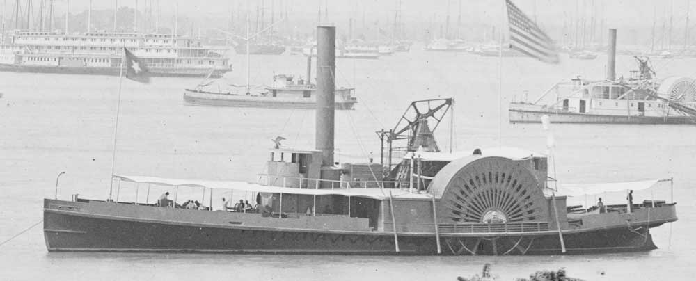
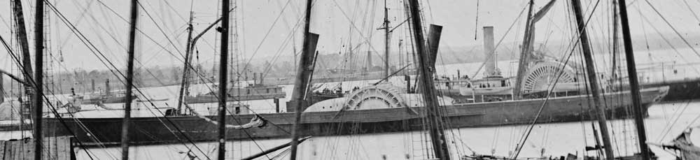
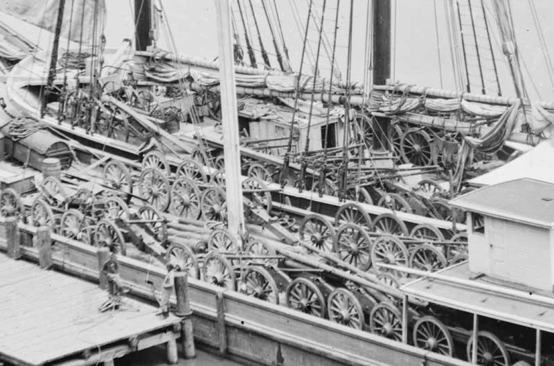
The official records of the navies have a report showing a number of ships stationed in the James River on April 1st, 1865. Since I am modelling late March, 1865, this is useful in terms of what ships might be in the area of City Point. Once identified, further searches on Wikipedia show some details and images of these vessels.
| ship | location | guns | class | length | |
| Commodore Barney | Appomattox River | 7 | paddle | 143 | 1 × 100-pounder rifle, 3 × 9 in (230 mm) smoothbore guns |
| Mackinaw | Appomattox River | 10 | paddle | 206 | 2 10 inch, 4 9 inch, 2 24 pdr, 1 12 pdr |
| Sassacus | Appomattox River | 12 | paddle | 205 | 2 100 pdr parrot, 4 9" dahlgren, 2 24pdr howitzers, 1 12 pounder rifle, 1 12 pdr smoothbore |
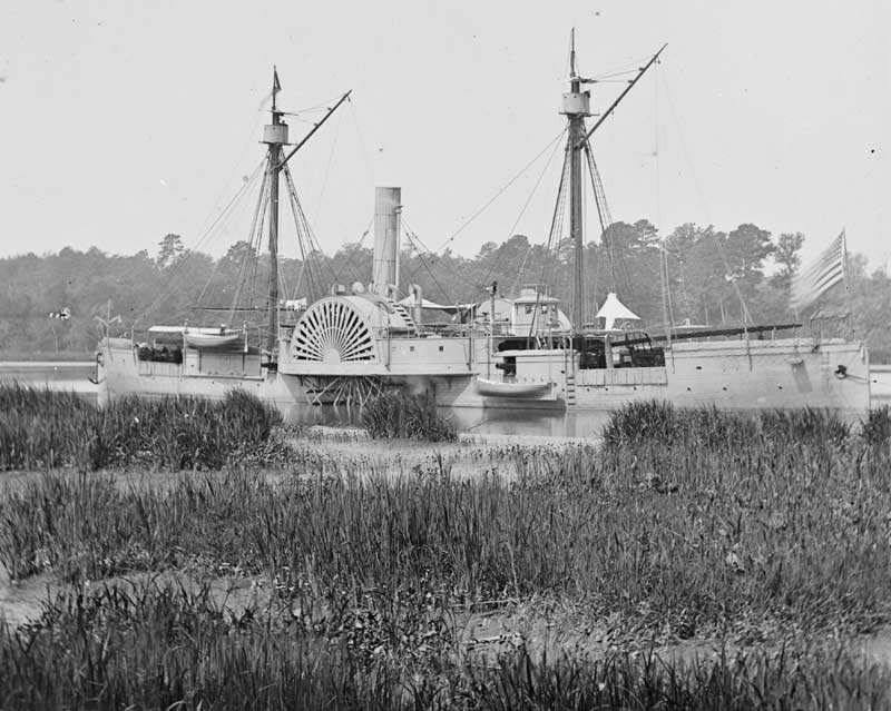
| Alabama | City Point | 10 | paddle | 214 | eight 32 pounder smooth-bore |
| Tristram Shandy | City Point | 4 | paddle | 222 | three 12 pounders, 1 20 pdr Parrott |
| Phlox | Commodore Radford's flagship | - | paddle | 145 | |
| Unit | Fleet engineer's tug | - | screw | ||
| Fahkee | Hampton Roads | 5 | screw | ||
| Mendota | Hampton Roads | 10 | paddle | ||
| Alpha | James River | - | screw | 72 | 1 spar torpedo |
| Bat | James River | 2 | paddle | 230 | 1 30 pdr parrott, 2 12 pdr smoothbores |
| Chippewa | James River | 6 | screw | ||
| Clinton | James River | - | screw | ||
| Clematis | James River | 3 | paddle | ||
| Daylight | James River | 8 | screw | ||
| Delta | James River | - | screw | ||
| Eutaw | James River | 10 | paddle | ||
| Epsilon | James River | - | screw | 66 | ? |
| Glance | James River | - | screw | ||
| Gamma | James River | - | screw | 65 | 1 spar torpedo |
| Harcourt | James River | - | screw | ||
| Kansas | James River | 8 | screw | ||
| Lilac | James River | 2 | screw | ||
| Malvern | James River | 12 | paddle | ||
| Osceola | James River | 10 | paddle | ||
| Pequot | James River | 8 | paddle | ||
| Pawtuxet | James River | 10 | paddle | ||
| Pontoosuc | James River | 12 | paddle | ||
| Picket launch No. 4 | James River | 1 | screw | ||
| Seneca | James River | 5 | screw | ||
| Spuyten Duyvil | James River | - | torpedo boat | ||
| Saffron | James River | - | screw | ||
| Unadilla | James River | 6 | screw | ||
| Watch | James River | 1 | screw | ||
| Zeta | James River | - | screw | ||
| Mount Washington | James River Supply vessel | 1 | paddle | ||
| Delaware | James River, ordered to sounds | 4 | paddle | ||
| Ben Morgan | Norfolk | - | hulk | ||
| Charles Phelps | Norfolk | - | hulk | ||
| Cohasset | Norfolk | 1 | screw | ||
| Picket launch No. 6 | Norfolk | 1 | screw | ||
| Roman | Norfolk | - | hulk | ||
| Wyanotte | Norfolk | 5 | screw | ||
| Biguonia | Norfolk navy yard | 3 | screw | ||
| Chicopee | Norfolk navy yard | 10 | paddle | ||
| Commodore Morris | Norfolk navy yard | 7 | paddle | ||
| Young America | Norfolk navy yard | 2 | screw | ||
| Zouave | Norfolk navy yard | 2 | screw | ||
| Poppy | Norfolk nay yard | 2 | screw | ||
| Gettysburg | Ordered to City Point | 7 | paddle | ||
| Emma | Ordered to Hampton Roads | 8 | screw | ||
| Fort Donelson | Ordered to Hampton Roads | 1 | paddle | ||
| Cactus | Pagan Creek | 3 | paddle | ||
| Huron | Pagan Creek | 5 | screw | ||
| New Berne or Florida | Supply Vessel | - | screw and paddle | ||
| Maumee | Tender to president | 8 | screw | 190 | 1 100 pdr parrot, 1 30 pdr parrot, 4 24 pdr guns 1 12 pdr rifle |
| Atlanta | Trent's Reach | 3 | screw | ||
| Commodore Perry | Trent's Reach | 5 | paddle | ||
| Casco | Trent's Reach | 2 | screw | ||
| Lehigh | Trent's Reach | 2 | screw | ||
| Monadnock | Trent's Reach | 4 | screw | ||
| Massasoit | Trent's Reach | 10 | paddle | ||
| Mahopac | Trent's Reach | 2 | screw | ||
| Onondaga | Trent's Reach | 4 | screw | ||
| Saugus | Trent's Reach | 2 | screw | ||
| Sangamon | Trent's Reach | 2 | screw |
When modeling the James River and vessels on it, it can be helpful to understand the nature of the river. The river runs fromthe Appalacian Mountains to near the mouth of the Chesapeake Bay. The head of navigation is at the falls at Richmond. This is what made Richmond so important. Though the head of navigation is at Richmond, navigating to that point, involves following a narrow channel. Much of the area of the river is actually shallow flats, with depths of only a few feet.
Take a look at this natical chart of the area around City Point. It is a crop of a civil war era US Navy chart of the James River, found in the Library of Congress digitized online archives.
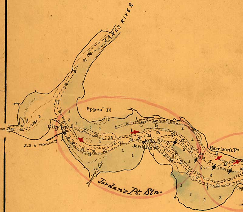
It should be clear that any boats that draw more than a few feet, have no choice, but to stay in the channel that brushes alongside the wharfs at City Point. The accounts of the Battle of Trent's Reach in January, 1865 are as much accounts of the groundings of the Confederate attackers when they strayed from the narrow channel as anything else. Finally, period photographs of City Point, show the that the shoal areas are indeed, devoid of vessels.