The day after VCF east, I visited a couple of Civil War sites north of Atlanta. I already reported on my visit to Allatoona Pass.
After hiking around Allatoona, I drove south to Kennesaw and did the hike to the top of Kennesaw Mountain, which took about an hour. Kennesaw Mountain rises about 800 feet above the surrounding countryside. The view from the top is impressive. You can see from Atlanta in the south to Allatoona in the North, a span of something like 50 miles. Except for a few isloated Mountains, the country is of a gently rolling nature, much like eastern Massachusetts. It is no wonder that the few mountains played such a key role in the Civil War Campaign for Atlanta. The holders of those hills, had huge advantages of observation and communication. Here is a picture I took from the top of Kennesaw, looking north.
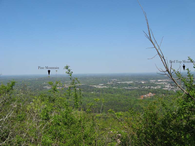
Looking north from Kennesaw
The other thing I noticed while hiking Kennesaw is that the main Confederate trench lines were located near the top. Certainly part of the reason for this is that the energy of any attackers would be reduced by the climb up to reach them. Certainly, making a successful attack against this position would have been very difficult. However another the thing to keep in mind is that the mountain is only about a mile long, part of a six mile long defensive line. Eventually Sherman was able to flank this line, like the ones before it.